Augmented reality goes to work for nuclear fusion
The ITER Organization has begun deploying software that allows people to walk around the site and compare as-is work to as-designed 3D models on their tablets and smartphones.
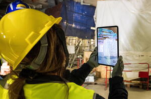
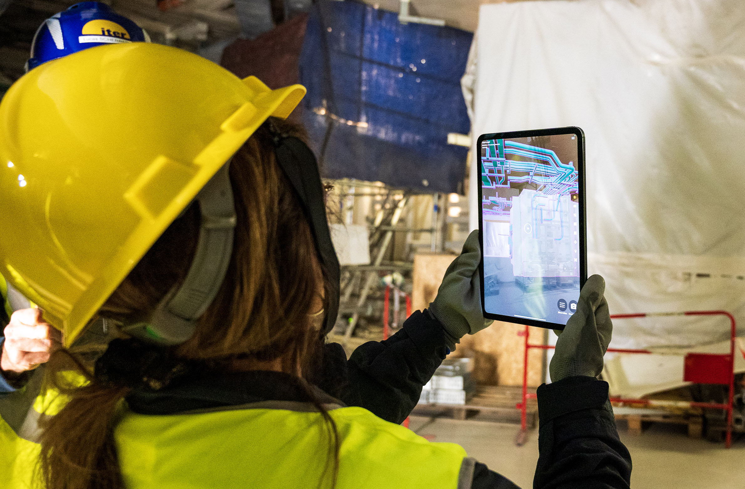
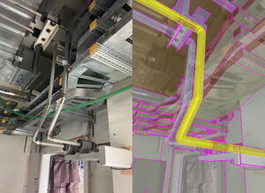
Using an off-the-shelf augmented reality application called Gamma AR, engineers and technicians at ITER can now see if an installed component fits in the way it was planned during design—and much more. The software is similar to the app that allows IKEA customers to see what a piece of furniture would look like in their house or office. “You have as-built in front of you, and you can project the as-designed version on top of that,” says Lucas Scherrer, building integration manager in the Integration and CAD Support Section. “Several features of the application help you spot any differences.”
Lucas and his colleagues worked with the surveillance and field design teams to estimate the benefits of the application, which they expect to include savings in both cost and time. A single rework costs thousands of euros—and when the problem isn’t spotted early, the costs rise sharply. Other equipment can be added on top of a faulty layout, making it more difficult to reach and fix the problem area, or a mistake may not be noticed before a contractor finishes work on the site, making it necessary to assign a different contractor to fix it. “It could take months to spot an error without the application,” says Scherrer. “With the new AR capability, you see it in minutes.”
“With the tablet, you have your 3D model overlaid on reality,” he explains. “If you spot an issue, you can click on the components on your screen and the application retrieves more information about the equipment, including identification. You can add a description of what you’re looking at. The application creates what’s called an ‘issue,’ which you can then assign to someone to be solved.”

The tool not only helps find problems, but it also helps find solutions, by making it easy to determine what needs to be corrected. “Once you get the location, you can go back to your office and retrieve the 3D model directly from Navisworks,” says Scherrer. “You can move images around to try to find better fits.”
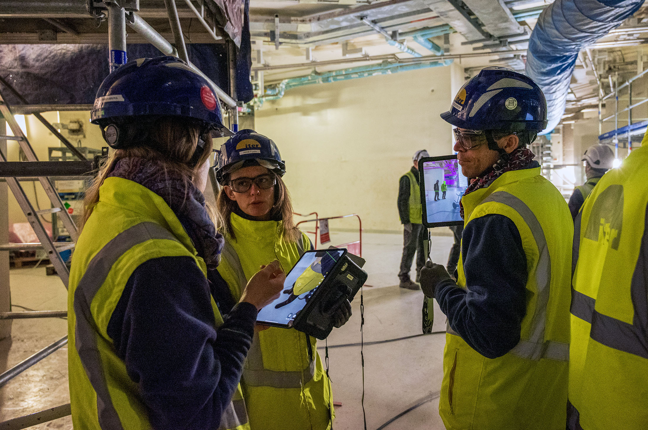
To begin deployment of the application, Integration and CAD Support bought 10 “ruggedized” (durable) tablets for the surveillance and field design teams, its first set of target users. Several other groups are also interested in applying the capabilities to other use cases. For example, the same AR application can let users see what future installations will look like on top of the real components in front of them—something teams who are about to install equipment will find useful.
The same capability can also be used to show visitors what the site will look like. “We have a VR room where we can show the finished facility,” says Scherrer. “But now that assembly is going fast, it’s nice to bring people on site to show them the future in situ. Ultimately, we plan to spread the new application widely among ITER staff.”

Developing a solution and procedures around the app
Gamma AR is widely used by other companies doing construction and assembly with more or less the same surveillance needs as ITER. “The only thing we had to do was set up the workflow that takes the 3D models from Navisworks and makes them available to the app,” says Scherrer. “This was done by ITER IT and the Design Office.”
Because Apple hardware and iOS deliver the processing power needed to render complex images quickly and smoothly, the app is optimized to run on iPhones and iPads. Moreover, the Pro versions of both include an embedded Lidar, which helps the app align with the structures in front of the user.
There will be two ways for users to align the model with what is in front of them onsite. The first is the direct approach. The Lidar scans the floor, and the application displays an image on which the user can select one point and an edge, allowing the software to align. The second approach, which has not yet been installed on the site, will allow subsequent users to align by clicking on a QR code glued on the wall by a more technically savvy user who followed the direct procedure. The QR code solution is expected to be made available in April.
Once the app aligns with the as-is layout it can overlay the appropriate 3D models, very much like how popular astronomy apps like Sky Map or SkySafari can overlay stars and constellations on a quadrant of night sky. “The maturity of the technology has allowed us to implement a very intuitive visual solution that will significantly reduce the time to repair, improve the quality of installation, and save everybody a lot of time,” says Scherrer.